Analyze satellite or aerial night images
Data acquired at night from the sky or from space can be used to locate light sources and quantify their emissions. Combined with other types of data (lighting, topography, demographics, etc.), they provide invaluable information for analyzing parks and light-ing practices.


Lighting shutdown detection
To reduce nuisance and cut energy consumption, the practice of lighting shutdowns is becoming more widespread, particularly in the middle of the night (from late evening to early morning).
Detecting these lighting shutdowns is a way of assessing lighting practices within a territory, but it is also necessary before simulating the quality of the night sky at the end of the night (evening and early morning periods).
On a large scale, our Asio software uses low-resolution night-time satellite images to detect areas where lighting shutdowns are taking place.
In addition, analysis of high or very high resolution images can help identify lighting shutdowns at the scale of individual points of light.
What data do we work with?
What tools have we developed?



Identification of private lighting sources
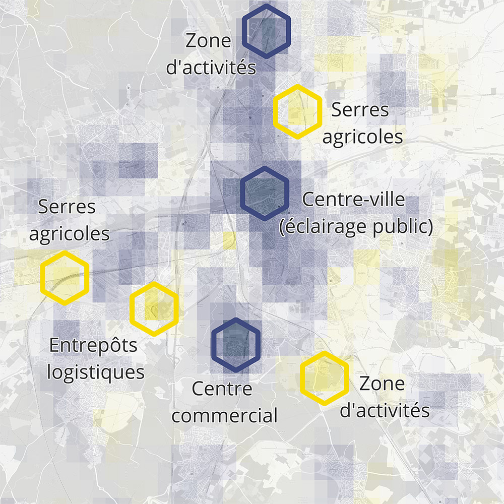
Unlike public lighting, data on private lighting (installed in industrial, commercial, agri-cultural or transport buildings or infrastructures, etc.) is rarely communicated. Yet these sites can make a very significant contribution to light pollution in a given area.
To identify these private sources and classify them according to their level of impact, we have developed automatic detection methods based on cross-analysis of satellite or aerial images, street lighting data, and topographical and cadastral data.
Each identified site is then validated by photo-interpretation.
What data do we work with?


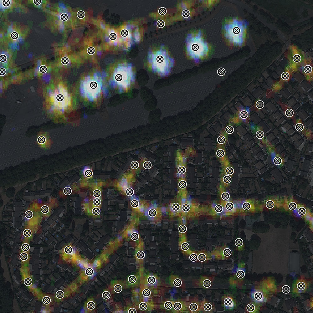
Estimated mapping of light points
High or very high resolution satellite and aerial images enable us to precisely quantify light emission levels at every point in a territory.
By extracting "radiance" peaks from these images, it is possible to determine the likely location of light points in the area.
This type of imagery is therefore particularly useful for approximate reconstruction of lighting parks in the absence of known light point data.
This method can also be used to isolate private lighting sources within an area where the location of public lighting points is known.
What data do we work with?


Time tracking of light emissions
Comparative analysis of satellite or aerial night-time images acquired at different peri-ods enables us to track changes in light emissions over time.
In addition to global monitoring on a territory-wide scale, this type of analysis enables us to detect more precisely the areas and light sources that have experienced the greatest variations over a given period, by cross-referencing satellite or aerial data with topographical and cadastral data.
In particular, this type of monitoring can be carried out using the low-resolution images acquired by the VIIRS-DNB instrument, available since 2014 in annual or monthly for-mat.
What data do we work with?

Our solutions in action
Would you like to see concrete examples of our applications?
We put our tools and methods to work on a large number of projects every year.

